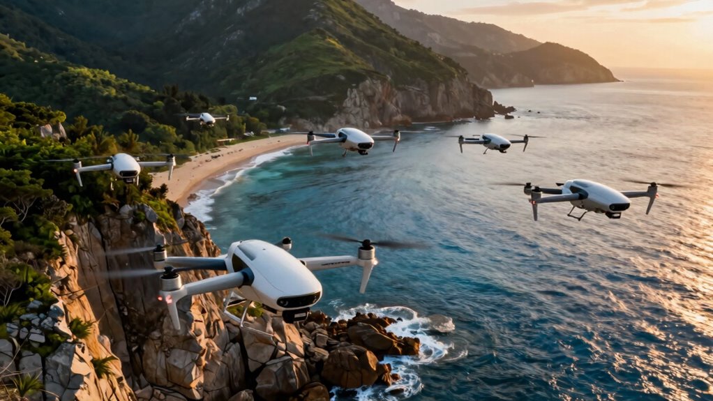
Choosing a drone for coastal and sea country surveys depends on what needs observing: shoreline features from above, accurately positioned mapping data, or underwater assets below the surface. I put the Autel EVO II Pro RTK V3 first for geospatial survey work because its RTK positioning and mission planning are better suited to repeatable mapping than the camera-focused options. The DJI Mavic 4 Pro is my pick for high-detail visual inspection and flexible aerial documentation, while the GLADIUS MINI S is the only option here designed to inspect underwater environments.

Prime made for students and young adults
- Fast, free delivery for dorm and study essentials
- Prime Video and Amazon Music included
- Member-only deals
The main tradeoff is between survey-grade positioning, photographic detail, and operating environment. A 100MP camera can record striking coastal imagery, but image resolution alone does not establish accurate map coordinates. Likewise, an underwater vehicle cannot replace an aircraft when the job is shoreline coverage. I rank the products by their fit for coastal survey tasks, then weigh workflow demands, stated capabilities, and limitations. Check local aviation, marine, land-access, and cultural heritage requirements before planning any survey.
Key Takeaways
- For repeatable aerial mapping, I rank the Autel EVO II Pro RTK V3 first because its RTK module is specified for centimeter-level positioning and it supports planned routes.
- The DJI Mavic 4 Pro is the stronger choice for detailed visual recording, with a 100MP camera and dual telephoto lenses, but those features do not replace RTK positioning.
- The GLADIUS MINI S addresses a different survey need: underwater inspection to a stated 330-foot depth, with a tether that limits movement but supports a direct viewing connection.
- The Mavic 4 Pro Fly More Combo adds field accessories to the same basic drone platform; it is a workflow bundle, not a higher-accuracy mapping model.
- Coastal operations need separate planning for wind, salt exposure, battery reserves, airspace, water access, and survey control; no listed flight-time or transmission figure guarantees usable coverage.
| Autel Robotics EVO II Pro RTK V3 |  | Best Overall for RTK-Aided Coastal Mapping | Positioning: RTK: 1 cm + 1 ppm horizontal; 1.5 cm + 1 ppm vertical | Video capture: 6K | Flight time: 38 minutes | VIEW ON AMAZON | See Our Full Breakdown |
| DJI Mavic 4 Pro Drone with DJI RC 2 |  | Best for High-Detail Aerial Documentation | Camera: 100MP Hasselblad | Video: 6K/60fps HDR | Telephoto: Dual telephoto lenses | VIEW ON AMAZON | See Our Full Breakdown |
| GLADIUS MINI S Underwater Drone with 4K EIS Camera |  | Best for Underwater Coastal Inspection | Camera: 4K video, 12MP photos | Sensor: 1/2.3-inch Sony CMOS | Maximum depth: 330 feet | VIEW ON AMAZON | See Our Full Breakdown |
| DJI Mavic 4 Pro Drone Fly More Combo with Accessories |  | Best Field-Ready Aerial Bundle | Model: DJI Mavic 4 Pro | Bundle type: Fly More Combo | Memory: 64GB card listed | VIEW ON AMAZON | See Our Full Breakdown |
| drone for coastal and sea country survey | Camera | Obstacle sensing |
|---|---|---|
| Autel Robotics EVO II Pro RTK | — | — |
| DJI Mavic 4 Pro Drone with DJI | 100MP Hasselblad | Omnidirectional sensing, stated down to 0.1 lux |
| GLADIUS MINI S Underwater Dron | 4K video, 12MP photos | — |
| DJI Mavic 4 Pro Drone Fly More | — | Omnidirectional, as listed |
More Details on Our Top Picks
Autel Robotics EVO II Pro RTK V3
For a survey where map placement and repeatability matter more than cinematic framing, I rank the Autel EVO II Pro RTK V3 first. Its RTK module is specified for 1 cm + 1 ppm horizontal and 1.5 cm + 1 ppm vertical positioning, giving it a clear mapping-oriented advantage over both Mavic listings. That specification is not a promise of final map accuracy by itself: control, correction availability, camera calibration, flight height, processing, and field conditions still affect results. But among these four products, Autel is the one whose supplied details most directly address geospatial positioning.
Its autonomous waypoint, rectangle, and polygon tasks also suit planned shoreline or site coverage better than a camera-first flight workflow. Compared with the Mavic 4 Pro, the Autel gives up the listed 100MP Hasselblad camera and 51-minute maximum flight time; its stated flight time is 38 minutes, and video capture is listed at 6K. In return, it offers RTK and a survey-focused mission approach. The 15 km transmission range is useful context for operating plans, but I would not treat it as a safe or legal distance to fly over coastal water.
The tradeoff is setup. The product information notes that mapping software requires a high-performance Windows PC with specific NVIDIA GPU drivers, and the advanced workflow may be a poor fit for occasional users. I would choose it when location-aware mapping is central and a capable operator can manage data processing. If the assignment is mainly visual documentation, the Mavic is simpler to justify; if the target is underwater, this aircraft cannot do the GLADIUS MINI S’s job.
Pros:- RTK module specified for centimeter-level positioning under stated conditions.
- Supports waypoint, rectangle, and polygon mission tasks for planned coverage.
- 6K video capture provides useful visual documentation alongside mapping work.
- Bundle includes a smart controller, multiple batteries, chargers, and protective accessories.
Cons:- Mapping software has specific high-performance Windows PC and NVIDIA driver requirements.
- The 38-minute stated flight time is shorter than the Mavic 4 Pro’s stated 51 minutes.
- RTK capability does not, by itself, guarantee a survey-ready map or remove the need for validation.
Best for: Survey teams needing RTK-aided aerial mapping, repeatable planned routes, and a bundled professional control setup.
Not ideal for: New pilots, teams without the specified Windows and NVIDIA computing setup, or buyers whose main requirement is underwater inspection or cinematic shoreline footage.
- Positioning:RTK: 1 cm + 1 ppm horizontal; 1.5 cm + 1 ppm vertical
- Video capture:6K
- Flight time:38 minutes
- Maximum transmission range:15 km
- Battery capacity:5000 mAh
- Mission tasks:Waypoint, rectangle, and polygon routes
- Control:Remote control; smart controller included in bundle
Our verdict“I would choose the Autel first when coastal mapping accuracy and repeatable routes outweigh easier setup and longer stated flight time.”
DJI Mavic 4 Pro Drone with DJI RC 2
I place the DJI Mavic 4 Pro second because it is the lineup’s strongest fit for recording detailed coastal scenes, assets, and visual changes from the air. Its 100MP Hasselblad camera, dual telephoto lenses, and 6K/60fps HDR video offer framing flexibility that the supplied Autel specifications do not match. Telephoto options can help capture distant features without flying as close, though they do not substitute for a mapped flight plan or accurate georeferencing. The 360-degree gimbal adds creative camera movement, which is more relevant to documentation and presentation than to survey positioning.
The stated 51-minute maximum flight time is longer than the Autel’s 38 minutes, a useful difference for coastal work where launching and relocating can take time. Actual endurance will depend on conditions and mission setup, so I would plan conservative battery reserves rather than treat the published maximum as productive survey time. Its 30 km O4+ transmission figure is also not a practical authorization to fly beyond visual line of sight or over open water. Compared with the Fly More Combo, this listing is the more straightforward choice if the buyer wants the drone and controller rather than a collection of added field accessories.
This is not my first choice for coordinate-critical mapping because the supplied details do not list RTK. I would favor the Autel when repeatable, positioned survey outputs are the priority. The Mavic makes more sense when the deliverable is detailed imagery, inspection records, or footage that communicates shoreline conditions clearly. Android users should also account for the stated DJI Fly app issue: the app is no longer available through Google Play, and manual installation may bring compatibility concerns.
Pros:- 100MP Hasselblad camera and dual telephoto lenses suit detailed visual recording.
- 6K/60fps HDR video supports high-quality coastal documentation.
- Stated maximum flight time of 51 minutes exceeds the Autel’s listed 38 minutes.
- Omnidirectional obstacle sensing and a rotating 360-degree gimbal add operational and framing flexibility.
Cons:- The supplied specifications do not list RTK positioning for survey mapping.
- DJI Fly requires manual download on Android, with possible compatibility issues.
- Maximum transmission range and flight time should not be treated as usable mission guarantees.
Best for: Experienced aerial operators who need detailed coastal imagery, telephoto views, HDR video, and a long stated flight time.
Not ideal for: Survey teams requiring listed RTK positioning, buyers wanting an underwater vehicle, or Android users unwilling to manage the stated app installation issue.
- Camera:100MP Hasselblad
- Video:6K/60fps HDR
- Telephoto:Dual telephoto lenses
- Maximum flight time:51 minutes
- Transmission:Up to 30 km O4+ 10-bit HDR
- Gimbal:360-degree Infinity Gimbal
- Obstacle sensing:Omnidirectional sensing, stated down to 0.1 lux
- Included:Drone, DJI RC 2 controller, one battery, 100W USB-C power adapter
Our verdict“I recommend the Mavic 4 Pro when image detail and flexible aerial documentation matter more than listed RTK mapping capability.”
GLADIUS MINI S Underwater Drone with 4K EIS Camera
The GLADIUS MINI S is not a competitor to the aerial drones in the usual sense; it covers the part of a coastal survey that they cannot reach. Its 330-foot depth rating and 4K stabilized camera make it the specialist pick here for underwater observation of structures, marine environments, or submerged features. A Sony CMOS sensor, two 1200-lumen lights, and 12MP stills add practical detail for close inspection. Where the Mavic records a shoreline from above and the Autel targets positioned aerial mapping, this vehicle gives an operator a live view below the surface.
Its stated battery life of up to four hours is a different kind of endurance from a flight-time figure, but the wired remote connection shapes how it can be used. The tether supports direct viewing and recording, yet it restricts movement and needs active management around obstacles, currents, and vessel operations. That limitation is a real contrast with the untethered aerial options: the GLADIUS can inspect underwater areas, but it cannot quickly cover a broad coastline from above. Its four-knot maximum speed also makes it better suited to deliberate inspection than rapid area coverage.
I would select it only when the survey includes submerged targets or water-column viewing. It does not provide aerial maps, and its depth rating should not be confused with suitability for every marine condition. Buyers should check tether length and operating details for their planned site, since those details are not included in the supplied specifications. The 3.5-hour charging time also makes spare power planning relevant for extended field days. Against the Autel and Mavic, this is the most specialized choice—and the only one that works below the surface.
Pros:- Designed for underwater inspection, with a stated maximum depth of 330 feet.
- 4K video with electronic image stabilization and a 12MP photo mode.
- Two 1200-lumen LED lights support visibility during close inspections.
- Up to four hours of battery life and included 64GB storage.
Cons:- Wired connection restricts range and requires tether management.
- Charging takes a stated 3.5 hours.
- Its underwater role cannot replace aerial mapping or shoreline imaging.
Best for: Marine researchers, inspectors, and survey crews who need tethered underwater video and inspection to a stated depth of 330 feet.
Not ideal for: Anyone seeking aerial shoreline mapping, broad untethered coverage, or a single drone for both above-water and underwater work.
- Camera:4K video, 12MP photos
- Sensor:1/2.3-inch Sony CMOS
- Maximum depth:330 feet
- Maximum speed:4 knots
- Lighting:Two 1200-lumen LEDs
- Battery life:Up to 4 hours
- Connection:Wired remote controller; HDMI output
- Storage:64GB SD card included; supports up to 512GB
Our verdict“I would add the GLADIUS MINI S when underwater inspection is a defined survey task, not as a substitute for an aerial drone.”
DJI Mavic 4 Pro Drone Fly More Combo with Accessories
The Mavic 4 Pro Fly More Combo takes fourth place because its value in this comparison is mainly convenience and field organization, rather than a distinct survey capability. It is based on the Mavic 4 Pro platform, so it is the better match than the standard listing for teams who want accessories such as a backpack, landing pad, 64GB memory card, and cleaning kit in the package. Those items can make a mobile coastal workflow easier to organize, especially when launch areas are sandy or gear needs to be carried between sites. They do not make its imagery more accurately positioned than the standard Mavic’s.
Compared with the Autel, this combo still lacks listed RTK positioning, which keeps it behind for geospatial mapping. Compared with the standard Mavic 4 Pro, the drone platform and its core camera-led strengths are not presented as an upgrade here; the distinction is the bundle. The supplied listing mentions omnidirectional obstacle sensing, intelligent flight modes, and extended flight time, but gives no exact flight-time figure or full accessory count. I would verify the precise package contents before relying on it for a field deployment.
Bundle quality is another tradeoff. The supplied information warns that included third-party accessories may not match OEM quality, and bundle contents can vary from standard manufacturer packages. That matters on remote coastlines, where a poorly suited bag or accessory can create friction rather than reduce it. I would pick this version over the standard Mavic only when the listed accessories are useful and confirmed. If mapping accuracy is the deciding factor, spend attention on the Autel’s RTK workflow; if you already have compatible field gear, the standard Mavic may be the cleaner choice.
Pros:- Includes a backpack and landing pad for organizing mobile field operations.
- 64GB memory card, card reader, and card wallet support image handling.
- Shares the Mavic 4 Pro platform’s stated obstacle sensing and intelligent flight modes.
- Cleaning kit may help with routine care after dusty or sandy site work.
Cons:- No RTK positioning is listed, so it does not match the Autel for mapping-focused workflows.
- Bundle contents may vary, and third-party accessories may not match OEM quality.
- The supplied listing does not specify an exact flight-time figure or complete accessory details.
Best for: Mavic 4 Pro buyers who want a listed accessory bundle for mobile visual survey and field documentation.
Not ideal for: Teams choosing primarily for RTK mapping, buyers who already own suitable accessories, or operators who need guaranteed OEM accessory contents.
- Model:DJI Mavic 4 Pro
- Bundle type:Fly More Combo
- Memory:64GB card listed
- Field accessories:Backpack, landing pad, cleaning kit
- Data accessories:Card wallet and card reader
- Obstacle sensing:Omnidirectional, as listed
- Flight features:Intelligent flight modes; long flight time stated without an exact figure
Our verdict“I would choose this bundle over the standard Mavic only when its confirmed accessories simplify field logistics; it is not a mapping-accuracy upgrade.”

How We Picked
I ranked these four products by how directly they support coastal and sea country survey tasks, not by camera specifications alone. Mapping and repeat inspection benefit from planned routes and reliable positioning; visual documentation benefits from a capable camera and useful framing options; underwater work needs a vehicle built to operate below the surface. Because the lineup includes both aerial and underwater equipment, I treat them as tools for different parts of a survey rather than as interchangeable aircraft.
I also compared practical field considerations: stated flight or battery endurance, control and mission workflow, payload or imaging information, portability, and known setup limits. The Autel leads for positioning-led mapping, while the standard Mavic is the more versatile aerial imaging choice. Its Fly More Combo earns a separate role for accessory readiness, not a separate claim of better survey data. The GLADIUS MINI S is evaluated for underwater inspection, where tether management and depth rating matter more than aerial range.
Product details here come from the supplied specifications and descriptions. They do not establish regulatory approval, saltwater corrosion resistance, survey accuracy under every operating condition, or compatibility with a particular geographic information system. Before relying on collected data, I would confirm coordinate reference systems, ground control or validation needs, software support, and the exact contents of any bundle. For work on or near Country, I would also plan engagement, permissions, data stewardship, and access in line with the relevant community protocols.
| drone for coastal and sea country survey | Obstacle sensing |
|---|---|
| Autel Robotics EVO II Pro RTK | — |
| DJI Mavic 4 Pro Drone with DJI | Omnidirectional sensing, stated down to 0.1 lux |
| GLADIUS MINI S Underwater Dron | — |
| DJI Mavic 4 Pro Drone Fly More | Omnidirectional, as listed |
Factors to Consider When Choosing Drone For Coastal And Sea Country Surveys
I would begin by defining the survey deliverable, then match the platform to the environment. Aerial photographs, georeferenced maps, and underwater inspection records are different outputs, and one device in this lineup cannot perform all three jobs.Match the platform to the survey task
For positioned aerial mapping, the Autel is the only listed product with RTK specifications and structured mission tasks, which gives it the clearest survey-oriented role. For visual shoreline records, the Mavic 4 Pro offers the most detailed stated camera package. The Fly More Combo keeps that same camera-led role while adding accessories. For submerged inspection, the GLADIUS MINI S is the relevant choice; its depth rating and tethered camera solve a different problem from aerial coverage.
If a project requires both shoreline mapping and underwater inspection, I would plan for two systems or a combination of specialist providers rather than expect one drone to do everything. Define the output format, required coordinate reference, coverage area, and validation method before selecting hardware.
Treat positioning and camera detail as separate strengths
A high-resolution camera can record fine visual detail, but resolution alone does not show where an image belongs on a map. RTK positioning can improve the aircraft’s location information, but it does not automatically certify a finished survey. Processing choices, camera settings, ground control, correction sources, terrain, and quality checks all affect the result. I would confirm the accuracy requirement with the people who will use the data, then check whether the aircraft, processing software, and field method can meet it.
The Mavic’s 100MP camera and dual telephoto lenses favor flexible image capture. The Autel’s RTK feature favors a mapping workflow. Buyers who need both should check whether their workflow can combine the required imagery and positioning data, rather than assuming a stronger camera covers a positioning gap.
Plan for coastal conditions and legal operating limits
Coastlines can bring changing wind, spray, salt, glare, sand, and limited safe launch areas. The supplied product information does not confirm a saltwater protection rating for the aerial drones, so I would avoid treating either as marine-proof. Keep equipment sheltered, follow manufacturer care instructions, and build a conservative return reserve into every flight plan. A stated maximum flight time or transmission range is not the same as dependable coverage in wind or a permission to fly farther away.
Check aviation rules, airspace, visual line-of-sight requirements, land access, marine traffic, and any local restrictions before fieldwork. Where surveys involve Country, community-held knowledge, culturally sensitive locations, or access controlled by Traditional Owners, I would plan engagement, consent, data handling, and reporting with the relevant people before collecting imagery.
Account for batteries, tethering, and field workflow
The Autel listing includes multiple batteries and chargers, while the standard Mavic listing specifies one battery. The Fly More Combo may help with field organization, but I would verify the exact contents before depending on it. Actual productive coverage depends on launch setup, travel between sites, wind, reserve requirements, and battery rotation—not only the maximum flight time printed in a specification.
For the GLADIUS MINI S, the long stated battery life does not remove the need to manage a tether. Check the operating area for snags, currents, and safe places for the operator and controller. A cable can provide a direct viewing link but narrows the vehicle’s freedom of movement. Its 3.5-hour stated charging time also makes recharge planning relevant for multi-session work.
Check software, data handling, and bundle details
Before choosing the Autel, confirm that the team has a compatible Windows computer and the specified NVIDIA driver setup for mapping software. For either Mavic listing, Android users should account for the stated need to install DJI Fly manually rather than through Google Play and check device compatibility. Also confirm image formats, storage needs, processing tools, and how files will be backed up in the field.
Bundle listings deserve a contents check. The Fly More Combo names a backpack, landing pad, memory card, cleaning kit, and data accessories, but the supplied description warns that contents may vary and third-party parts may not match OEM quality. Compare the included items with the needs of the actual survey team, not just the bundle label.
Frequently Asked Questions
Which option is best for coastal mapping?
I would start with the Autel EVO II Pro RTK V3 when the deliverable is an aerial map that needs strong positioning support and repeatable planned routes. Its RTK specifications and mission tasks set it apart from the Mavic listings. The final result still depends on the correction source, control and validation plan, flight setup, and processing workflow, so I would confirm those requirements before treating any collected data as survey-grade.
Is the DJI Mavic 4 Pro suitable for survey work?
It can suit visual survey and documentation, particularly when detailed imagery, telephoto framing, and HDR video are useful. The supplied information does not list RTK for this model, so I would not rank it ahead of the Autel for positioning-led mapping. A camera can help show condition and change, but buyers should match the image workflow to the required map accuracy and verify how the imagery will be georeferenced.
Can the GLADIUS MINI S replace an aerial drone?
No. The GLADIUS MINI S is an underwater vehicle, with a stated depth rating of 330 feet and a wired control connection. It can inspect submerged targets that the aerial models cannot see, but it cannot produce aerial shoreline coverage. For a project that includes both above-water mapping and underwater inspection, I would treat it as a complementary specialist tool rather than a replacement.
Does the Mavic 4 Pro Fly More Combo improve mapping accuracy?
The supplied listing describes the Fly More Combo as an accessory bundle for the Mavic 4 Pro platform; it does not list RTK or another mapping-positioning upgrade. Its backpack, landing pad, memory card, and related accessories may make field work more organized, but those items do not change the positioning distinction between the Mavic and the Autel. I would choose it for confirmed bundle convenience, not as an accuracy upgrade.
What should I check before flying or operating near the coast?
I would check local aviation and marine rules, airspace, land access, wind and weather, safe launch points, battery reserves, and equipment care needs around salt, spray, and sand. The supplied specifications do not establish saltwater resistance or guarantee maximum flight time and range in field conditions. For work on or near Country, I would also arrange appropriate permissions and engagement, and agree on respectful data collection and handling with the relevant community or authority.
Conclusion
My pick for RTK-aided coastal mapping is the Autel EVO II Pro RTK V3, provided the team can support its software and processing requirements. For operators whose priority is detailed aerial documentation, I would choose the DJI Mavic 4 Pro; its camera and telephoto options are stronger reasons to buy than any claim of mapping accuracy. Choose the Mavic Fly More Combo instead when its confirmed accessories fit your field routine and you do not already have suitable gear.
For underwater inspection, the GLADIUS MINI S is the clear specialist, but its tether and limited role make it an addition to an aerial survey setup, not a replacement. I would make the final choice from the data the project must deliver, then check local operating rules, equipment limits, software fit, and community protocols before deployment.
Halloween Picks
halloween
As an affiliate, we earn on qualifying purchases.