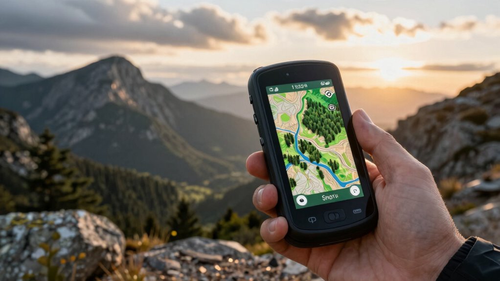
A GPS unit with topo maps and satellite imagery can mean a dedicated handheld, a satellite communicator with navigation, or a mapping service used on a phone—these options do not offer the same capabilities. I rank the Garmin GPSMAP 66i as the best overall fit here for buyers who want handheld navigation paired with satellite communication, while the Montana 750i suits those who want a larger screen and camera, and onX Hunt is a map-focused choice for hunters. A key tradeoff is that topo maps are not the same as satellite imagery: confirm the imagery source, offline access, and map coverage before buying. Screen size, battery demands, and emergency communication also shape which option fits a trip. Read on for how the ten picks compare and what to check before choosing.

Prime made for students and young adults
- Fast, free delivery for dorm and study essentials
- Prime Video and Amazon Music included
- Member-only deals
Key Takeaways
- The GPSMAP 66i is the most balanced handheld pick in this lineup because it combines GPS navigation with inReach satellite communication; the eTrex models prioritize simpler navigation without that communication feature.
- Topo mapping does not automatically mean satellite imagery. The listed Garmin handhelds center on navigation and topo maps, while onX Hunt is a digital mapping membership; verify imagery availability and offline rights for your intended device.
- The Montana 750i and Tread 2 serve different large-screen needs. The Montana is a handheld with satellite features, while the Tread 2 Overland Edition is aimed at vehicle-based route guidance.
- The eTrex 22x is the simpler value-oriented Garmin choice compared with the eTrex 32x, whose added sensors and wireless features matter more to buyers who will use them.
- There are two GPSMAP 66i listings, one renewed and one standard. Compare condition, included accessories, and seller terms rather than treating them as different navigation platforms.
| Garmin eTrex 22x Rugged Handheld GPS Navigator |  | Best for Battery-Simple Trail Navigation | Display: 2.2-inch color, 240 × 320 pixels | Preloaded maps: TopoActive routable roads and trails | Satellite systems: GPS and GLONASS | VIEW ON AMAZON | See Our Full Breakdown |
| Garmin eTrex 32x Rugged Handheld GPS Navigator |  | Best for Sensor-Assisted Topo Navigation | Screen: 2.2-inch color TFT, 240 × 320 | Map type: Preloaded topographical maps with routable trails and roads | Satellite systems: GPS and GLONASS | VIEW ON AMAZON | See Our Full Breakdown |
| Garmin GPSMAP 66i Handheld GPS and Satellite Communicator (Renewed) |  | Best for Satellite Imagery and Backcountry Check-Ins | Display: 3-inch sunlight-readable color | Mapping: Preloaded Garmin TOPO maps; direct-to-device Birdseye imagery downloads | Satellite network: Iridium | VIEW ON AMAZON | See Our Full Breakdown |
| Garmin inReach Explorer+ Handheld Satellite Communicator with Topo Maps and GPS Navigation |  | Best for Satellite Safety and Messaging | Model: 010-01735-10 | Satellite network: Iridium global coverage | Messaging: Two-way text messaging | VIEW ON AMAZON | See Our Full Breakdown |
| Garmin Montana 750i Rugged GPS Handheld with inReach Satellite Technology and 8-Megapixel Camera |  | Best Premium Large-Screen GPS | Display: 5-inch touchscreen | Camera: 8 megapixels | Satellite network: Iridium global coverage | VIEW ON AMAZON | See Our Full Breakdown |
| Garmin Tread 2 Overland Edition 8-Inch Rugged GPS Navigator Bundle |  | Best for Overland Satellite Imagery | Display: 8-inch high-resolution touchscreen | Water and dust resistance: IP67 | Preloaded maps: Topographic and road maps for North and South America | VIEW ON AMAZON | See Our Full Breakdown |
| onX Hunt Premium Digital Hunting Map Membership |  | Best for Hunting Land Boundaries | Membership term: 1 year | Map coverage: One chosen state; additional states can be added | Map types: Satellite imagery and 24K topographic maps | VIEW ON AMAZON | See Our Full Breakdown |
| Handheld GPS Navigator with 3.2-Inch Screen and USA Topographic Maps |  | Best for Long Battery Life | Screen: 3.2-inch sunlight-readable LCD; non-touchscreen | Satellite systems: GPS, Galileo, BeiDou, and QZSS | Position accuracy: Within 6 ft | VIEW ON AMAZON | See Our Full Breakdown |
| Garmin GPSMAP 65 Handheld GPS Navigator |  | Best for Challenging Terrain | Display: 2.6-inch color LCD, 160 × 240 resolution | Navigation: GPS with expanded GNSS and multi-band support | Maps: TopoActive maps and U.S. public land boundaries | VIEW ON AMAZON | See Our Full Breakdown |
| Garmin GPSMAP 66i Handheld GPS and Satellite Communicator |  | Best for Remote Safety | Display: 3-inch sunlight-readable color display | Mapping: Preloaded Garmin TOPO maps; Birdseye satellite imagery downloads | Satellite communication: Two-way messaging and interactive SOS via the Iridium network; subscription required | VIEW ON AMAZON | See Our Full Breakdown |
| topo map gps unit with satellite imagery | Display | Battery life | Navigation |
|---|---|---|---|
| Garmin eTrex 22x Rugged Handhe | 2.2-inch color, 240 × 320 pixels | Up to 25 hours in GPS mode | — |
| Garmin eTrex 32x Rugged Handhe | — | Up to 25 hours in GPS mode | — |
| Garmin GPSMAP 66i Handheld GPS | 3-inch sunlight-readable color | Up to 35 hours in tracking mode; up to 200 hours in Expedition mode | Multiple GNSS support and navigation sensors |
| Garmin inReach Explorer+ Handh | — | — | On-screen GPS routing |
| Garmin Montana 750i Rugged GPS | 5-inch touchscreen | — | GPS and Galileo |
| Garmin Tread 2 Overland Editio | 8-inch high-resolution touchscreen | — | — |
| onX Hunt Premium Digital Hunti | — | — | — |
| Handheld GPS Navigator with 3. | — | Up to 36 hours | — |
| Garmin GPSMAP 65 Handheld GPS | 2.6-inch color LCD, 160 × 240 resolution | Up to 16 hours | GPS with expanded GNSS and multi-band support |
| Garmin GPSMAP 66i Handheld GPS | 3-inch sunlight-readable color display | Up to 35 hours in tracking mode; up to 200 hours in Expedition mode | Multiple GNSS support and navigation sensors |
More Details on Our Top Picks
Garmin eTrex 22x Rugged Handheld GPS Navigator
The eTrex 22x suits hikers and cyclists who want a compact unit with routable topo trails and roads ready to use. Its sunlight-readable 2.2-inch screen keeps the map legible outdoors, while GPS and GLONASS support can help maintain positioning in more challenging terrain. Compared with the eTrex 32x, it gives up the electronic compass and barometric altimeter, so it offers less help with heading and elevation changes when stationary. Both eTrex models use two AA batteries and share the small display, but the 22x keeps the setup straightforward. It has no satellite imagery feature listed; its strength is dependable topo mapping, not aerial-photo context. The small screen and reliance on replaceable batteries are meaningful tradeoffs for long trips.
Pros:- Preloaded routable TopoActive roads and trails for hiking and cycling
- Sunlight-readable color display
- GPS and GLONASS support
- Up to 25 hours of GPS-mode battery life with replaceable AA batteries
Cons:- The 2.2-inch display limits how much map detail is visible at once
- Does not list satellite imagery downloads or satellite messaging
- Lacks the 32x’s 3-axis compass and barometric altimeter
Best for: Hikers and touring cyclists who want preloaded routable trails and the option to carry spare AA batteries
Not ideal for: Buyers who need aerial imagery, a larger map view, or a compass and barometric altimeter for navigation
- Display:2.2-inch color, 240 × 320 pixels
- Preloaded maps:TopoActive routable roads and trails
- Satellite systems:GPS and GLONASS
- Internal storage:8 GB
- Expandable storage:MicroSD card slot
- Battery life:Up to 25 hours in GPS mode
- Batteries:2 AA
Our verdict“Choose the eTrex 22x for compact, AA-powered topo navigation; choose the eTrex 32x if you want added heading and elevation sensors.”
Garmin eTrex 32x Rugged Handheld GPS Navigator
The eTrex 32x adds useful orientation tools to the compact mapping format shared with the eTrex 22x. Its 3-axis compass can show direction while standing still, and its barometric altimeter gives hikers extra context about elevation changes. That makes it the stronger choice for route finding where turns and climbs matter, even though both models share the same 2.2-inch screen, TopoActive maps, and AA battery format. It is still a small-screen GPS, not a large-area map viewer, and the supplied details do not list satellite imagery. Compared with the GPSMAP 66i, the 32x is simpler and does not add satellite messaging or Birdseye downloads. I’d choose it for sensor-guided trail work, while buyers who mainly need basic mapped tracks can save weight and complexity with the 22x.
Pros:- 3-axis compass provides heading information while stationary
- Barometric altimeter adds elevation context
- Preloaded routable topo roads and trails
- GPS and GLONASS support with microSD expansion
Cons:- Small 2.2-inch display makes detailed map browsing cramped
- Uses two AA batteries rather than a rechargeable pack
- No satellite imagery downloads or messaging are listed
Best for: Hikers and backcountry cyclists who use a compass bearing and elevation readings to stay oriented on mapped routes
Not ideal for: People who need a large screen, downloadable satellite imagery, or two-way satellite communication
- Screen:2.2-inch color TFT, 240 × 320
- Map type:Preloaded topographical maps with routable trails and roads
- Satellite systems:GPS and GLONASS
- Compass:3-axis
- Altimeter:Barometric
- Storage:8 GB internal; microSD card slot
- Battery life:Up to 25 hours in GPS mode
- Power:2 AA batteries
- Connectivity:ANT+
Our verdict“Pick the eTrex 32x over the 22x when compass and elevation sensors matter more than a larger screen or satellite imagery.”
Garmin GPSMAP 66i Handheld GPS and Satellite Communicator (Renewed)
The renewed GPSMAP 66i is the clearest match here for buyers who want topo maps alongside satellite imagery: it includes preloaded Garmin TOPO maps and supports direct-to-device Birdseye imagery downloads. Its 3-inch sunlight-readable screen gives that map detail more room than the eTrex 22x and 32x displays. The added value is two-way messaging and interactive SOS over Iridium, which can keep a traveler connected beyond cellular coverage; messaging requires a subscription. Against the inReach Explorer+, the 66i specifically lists Birdseye downloads and longer stated battery modes, while both add satellite communication to GPS navigation. The main caveats are its renewed condition and subscription-dependent messaging. It makes most sense for remote travelers who will use imagery and off-grid contact, rather than buyers seeking only a basic trail GPS.
Pros:- Direct-to-device Birdseye imagery downloads complement preloaded topo maps
- Two-way Iridium messaging and interactive SOS access
- 3-inch sunlight-readable display is larger than the eTrex screens
- Up to 200 hours in Expedition mode
Cons:- Satellite messaging and SOS features require a subscription
- Renewed condition may not suit buyers who want a new device
- Satellite communications may be regulated or prohibited in some jurisdictions
Best for: Remote hikers and expedition travelers who want downloadable aerial imagery, topo maps, and a way to message outside cell coverage
Not ideal for: Buyers seeking a new unit, a low-complexity trail GPS, or satellite messaging without an ongoing subscription
- Display:3-inch sunlight-readable color
- Mapping:Preloaded Garmin TOPO maps; direct-to-device Birdseye imagery downloads
- Satellite network:Iridium
- Navigation:Multiple GNSS support and navigation sensors
- Messaging:Two-way satellite messaging; subscription required
- SOS:Interactive SOS access to a 24/7 search and rescue monitoring center
- Battery life:Up to 35 hours in tracking mode; up to 200 hours in Expedition mode
- Battery:Rechargeable lithium-ion
- Condition:Renewed
Our verdict“Choose the renewed GPSMAP 66i if Birdseye imagery and off-grid messaging justify the subscription and renewed-device tradeoff.”
Garmin inReach Explorer+ Handheld Satellite Communicator with Topo Maps and GPS Navigation
The inReach Explorer+ is built around staying in touch and requesting help, with topo navigation as part of that package. Two-way texts use the Iridium network, and the SOS function connects to a 24/7 search and rescue monitoring center; both depend on a satellite subscription. For navigation, it includes DeLorme topo maps, GPS routing, and a compass, barometric altimeter, and accelerometer. Earthmate app compatibility provides access to downloadable maps and imagery, though the supplied data does not specify direct-to-device Birdseye downloads as the GPSMAP 66i does. The Explorer+ is a more focused communicator, while the 66i gives buyers a stated Birdseye imagery path and more detail about battery modes. Its older mapping ecosystem and subscription requirement make it less suited to someone who only wants a straightforward topo GPS.
Pros:- Two-way Iridium text messaging with global coverage
- SOS access to a 24/7 search and rescue monitoring center
- Preloaded DeLorme topo maps and on-screen GPS routing
- Earthmate app compatibility and IPX7 water rating
Cons:- Messaging and SOS require a satellite subscription
- No direct-to-device Birdseye imagery download feature is specified
- Less map-screen detail is provided than for the GPSMAP 66i
Best for: Backcountry travelers who prioritize two-way satellite texts and SOS access, with topo routing for planned routes
Not ideal for: Map-first buyers who specifically want documented Birdseye downloads or do not need satellite communication
- Model:010-01735-10
- Satellite network:Iridium global coverage
- Messaging:Two-way text messaging
- SOS monitoring:24/7 search and rescue monitoring center
- Maps:Preloaded DeLorme topo maps
- Navigation:On-screen GPS routing
- Sensors:Digital compass, barometric altimeter, and accelerometer
- App compatibility:Earthmate app for downloadable maps and imagery
Our verdict“Choose the Explorer+ when satellite messaging and SOS are your priority and app-supported map access is enough for your imagery needs.”
Garmin Montana 750i Rugged GPS Handheld with inReach Satellite Technology and 8-Megapixel Camera
The Montana 750i gives map viewing priority with a glove-friendly 5-inch touchscreen, a substantial step up from the 3-inch GPSMAP 66i and 2.2-inch eTrex models. Preloaded TopoActive and City Navigator maps cover outdoor routes and road navigation, while the 8-megapixel camera lets users capture location-linked trip context. It also brings Iridium two-way messaging and interactive SOS, plus a 3-axis compass and barometric altimeter. Those features make it the broadest all-in-one option in this group, but the supplied product data does not list direct satellite imagery downloads; buyers focused on Birdseye imagery should look to the GPSMAP 66i. The Montana is also a larger touchscreen unit, so it suits vehicle-supported trips and users who value readable maps more than a compact carry.
Pros:- Large 5-inch touchscreen is easier to inspect than the smaller handheld displays
- Preloaded TopoActive and City Navigator maps cover trail and road navigation
- Iridium two-way messaging and interactive SOS support off-grid trips
- 8-megapixel camera and navigation sensors add field utility
Cons:- Satellite messaging and SOS require an active subscription
- Satellite imagery downloads are not specified in the supplied data
- Larger touchscreen format is less compact than the eTrex or GPSMAP 66i
Best for: Overlanders and field users who want a large touchscreen, road and topo maps, a camera, and satellite messaging in one handheld
Not ideal for: Ultralight hikers or imagery-focused buyers who want a compact unit or documented Birdseye downloads
- Display:5-inch touchscreen
- Camera:8 megapixels
- Satellite network:Iridium global coverage
- Satellite features:Two-way messaging and interactive SOS; active subscription required
- Navigation:GPS and Galileo
- Preloaded maps:TopoActive and City Navigator
- Sensors:3-axis compass and barometric altimeter
- Connectivity:ANT+, Wi-Fi, and Bluetooth
- Model number:010-02347-00
Our verdict“Pick the Montana 750i for large, glove-friendly map viewing and broad trip tools; choose the GPSMAP 66i if Birdseye imagery is the deciding feature.”
Garmin Tread 2 Overland Edition 8-Inch Rugged GPS Navigator Bundle
The Tread 2 is the clearest fit here for drivers who want topo maps and satellite imagery on a large, glove-friendly screen. Its 8-inch display makes route planning and map detail easier to read from a vehicle than the smaller Garmin GPSMAP 65 screen, while preloaded North and South America topographic and road maps add elevation and land-use context. You can download satellite imagery over Wi-Fi without a subscription, then use route planning, GPX sharing, and trip syncing to coordinate an overland route. The tradeoff is that imagery must be downloaded before you lose Wi-Fi, and some map layers and accessory features are optional. I’d choose it for vehicle-based trips; hikers who prioritize a compact handheld should look at the GPSMAP 65 instead.
Pros:- Large 8-inch touchscreen is easier to read and operate with gloves than the GPSMAP 65’s 2.6-inch display
- Preloaded topographic and road maps cover North and South America
- Satellite imagery downloads over Wi-Fi without a subscription
- IP67 rating and included charger, long cable, and cleaning kit suit vehicle-based outdoor trips
Cons:- Satellite imagery must be downloaded while connected to Wi-Fi
- The 8-inch format is less practical for handheld hiking than the GPSMAP 65
- Some map layers and accessory features are optional
Best for: Overland drivers who want a large, glove-friendly screen, regional topo maps, and downloadable imagery for trip planning
Not ideal for: Hikers who need a small unit for pocket or pack carry, or anyone who needs satellite imagery without first downloading it over Wi-Fi
- Display:8-inch high-resolution touchscreen
- Water and dust resistance:IP67
- Preloaded maps:Topographic and road maps for North and South America
- Satellite imagery:Downloadable over Wi-Fi; no subscription required
- Route tools:Route planning, GPX sharing, and trip syncing
- Bundle accessories:USB wall charger, 10-foot USB-A to USB-C cable, and 7-in-1 cleaning kit
Our verdict“Choose the Tread 2 if you want a rugged, large-screen navigator for overland routes with downloadable satellite imagery and topo maps.”
onX Hunt Premium Digital Hunting Map Membership
For hunters, the onX Hunt membership adds information that general-purpose units such as the Garmin GPSMAP 65 do not foreground: color-coded public and private land boundaries, landowner names where available, and hunt-specific layers. Its combination of satellite imagery and 24K topographic maps helps relate terrain to access, roads, trails, and wildlife areas, while offline maps keep that context available away from service. The membership syncs across phones, tablets, and computers, and an onX Hunt Chip works with supported Garmin and Lowrance units. That hunting focus comes with narrower coverage: the membership covers one chosen state, and landowner details depend on available data. I’d pick it over the GPSMAP 65 for property and hunting layers, but the Garmin is a better fit for standalone handheld navigation.
Pros:- Combines satellite imagery and 24K topographic maps with hunting-specific layers
- Color-coded public and private land boundaries include landowner names where available
- Offline navigation and syncing support use across phones, tablets, and computers
- Compatible onX Hunt Chip works with supported Garmin and Lowrance GPS units
Cons:- One-year membership covers one chosen state; additional states may require an add-on
- Landowner names appear only where the data is provided
- It is a digital map membership rather than a dedicated GPS unit like the Garmin GPSMAP 65
Best for: Hunters who need offline topo and satellite maps alongside public and private land boundaries in one state
Not ideal for: Buyers who need a standalone GPS navigator, broad multi-state membership coverage, or landowner names everywhere
- Membership term:1 year
- Map coverage:One chosen state; additional states can be added
- Map types:Satellite imagery and 24K topographic maps
- Offline maps:Supported
- Compatible devices:Phone, tablet, and computer
- Hunt-specific layers:Game Management Units, wildlife areas, trails, and roads
- GPS chip compatibility:Compatible onX Hunt Chip for supported Garmin and Lowrance GPS units
Our verdict“Choose onX Hunt Premium if hunting access boundaries and offline map layers matter more to you than having a dedicated handheld GPS.”
Handheld GPS Navigator with 3.2-Inch Screen and USA Topographic Maps
This handheld prioritizes a long day outside over a touch-driven mapping experience. Its up to 36-hour battery life outlasts the Garmin GPSMAP 65’s stated 16 hours, while a 3.2-inch sunlight-readable screen, physical buttons, and IP66 water resistance suit rough field use. Four satellite systems—GPS, Galileo, BeiDou, and QZSS—provide multiple positioning sources, and the included USA topo maps, 3-axis compass, and barometric altimeter add orientation and elevation context. The main limitation for this roundup is that the supplied details do not specify satellite imagery support, unlike the Garmin GPSMAP 66i, which lists Birdseye imagery downloads. Its display is also non-touch, and software update support is unknown. I’d favor it for battery endurance and basic topo navigation, not imagery-led trip planning.
Pros:- Rated for up to 36 hours of battery life, compared with up to 16 hours for the Garmin GPSMAP 65
- Sunlight-readable 3.2-inch screen with physical buttons
- Supports GPS, Galileo, BeiDou, and QZSS
- Includes USA topographic maps, 32 GB storage, a 3-axis compass, and a barometric altimeter
Cons:- Non-touchscreen controls may make map interaction less direct
- Satellite imagery support is not specified in the supplied product details
- Software update support is listed as unknown
Best for: Day hikers and field users who value long battery life, physical controls, and USA topo maps
Not ideal for: Buyers who require confirmed satellite imagery support, a touchscreen, or clear information about software updates
- Screen:3.2-inch sunlight-readable LCD; non-touchscreen
- Satellite systems:GPS, Galileo, BeiDou, and QZSS
- Position accuracy:Within 6 ft
- Water resistance:IP66
- Battery life:Up to 36 hours
- Maps and storage:Preloaded USA topographic maps; 32 GB
- Navigation sensors:3-axis digital compass and barometric altimeter
- Charging and controls:USB-C charging; physical push buttons
Our verdict“Pick this handheld for long battery life and button-based topo navigation, but choose the GPSMAP 66i if satellite imagery is a must.”
Garmin GPSMAP 65 Handheld GPS Navigator
The GPSMAP 65 is the practical choice when reliable positioning and routable topo maps matter more than a large imagery display. Its expanded GNSS and multi-band support is aimed at challenging terrain, while the sunlight-readable 2.6-inch color screen keeps the unit compact and the physical buttons usable without touch input. Preloaded TopoActive maps and U.S. public land boundaries make it more ready for route finding than the onX Hunt membership, which focuses on hunting maps and requires a compatible device. For the specific goal of satellite imagery, though, the GPSMAP 66i has the clearer advantage: its product details list Birdseye imagery downloads, while the GPSMAP 65 details do not. Garmin Explore also requires a compatible smartphone for its app features. I’d pick this for compact, capable topo navigation, not imagery-first mapping.
Pros:- Expanded GNSS and multi-band support is suited to challenging terrain
- Includes routable TopoActive maps and U.S. public land boundaries
- Sunlight-readable color display and physical buttons work well for outdoor navigation
- Garmin Explore supports track, route, and waypoint management
Cons:- The 2.6-inch display is much smaller than the Garmin Tread 2’s 8-inch screen
- Satellite imagery downloads are not specified in the provided product details, unlike on the GPSMAP 66i
- Garmin Explore app features require a compatible smartphone
Best for: Hikers and hunters who need a compact button-operated GPS with multi-band positioning and U.S. public land maps
Not ideal for: Buyers who want a large map screen or confirmed satellite imagery downloads without relying on another product
- Display:2.6-inch color LCD, 160 × 240 resolution
- Navigation:GPS with expanded GNSS and multi-band support
- Maps:TopoActive maps and U.S. public land boundaries
- Connectivity:Bluetooth and ANT+
- Battery life:Up to 16 hours
- Controls:Physical buttons
- Memory card support:microSD
- Use:Camping, hiking, hunting, and outdoor activities
Our verdict“Choose the GPSMAP 65 for compact, multi-band topo navigation and public land maps; choose the GPSMAP 66i if listed satellite imagery support is a priority.”
Garmin GPSMAP 66i Handheld GPS and Satellite Communicator
The GPSMAP 66i is the strongest fit in this group for remote trips where maps and communication need to share one handheld. It pairs a 3-inch sunlight-readable display and preloaded Garmin TOPO maps with multiple GNSS support, and Birdseye satellite imagery downloads add the imagery layer the GPSMAP 65’s supplied details do not list. Its defining difference is inReach two-way messaging and interactive SOS over the Iridium network, which can provide a communication option beyond cellular coverage. That capability requires a subscription, and use may be regulated or prohibited in some jurisdictions. The GPSMAP 65 is a simpler choice if you only need handheld topo navigation; the Tread 2 offers a much larger screen for vehicle use. I’d choose the 66i when remote communication is part of the trip plan.
Pros:- Birdseye satellite imagery downloads complement preloaded Garmin TOPO maps
- Two-way messaging and interactive SOS use the Iridium satellite network
- Multiple GNSS support and navigation sensors aid outdoor positioning
- Rated for up to 200 hours in Expedition mode
Cons:- Satellite communication features require a subscription
- Use may be regulated or prohibited in some jurisdictions
- Its 3-inch handheld display is smaller than the Garmin Tread 2’s 8-inch screen
Best for: Backpackers and remote-area travelers who want topo maps, downloadable satellite imagery, and satellite messaging in one handheld
Not ideal for: Buyers who do not need satellite communication or do not want a subscription for messaging and interactive SOS
- Display:3-inch sunlight-readable color display
- Mapping:Preloaded Garmin TOPO maps; Birdseye satellite imagery downloads
- Satellite communication:Two-way messaging and interactive SOS via the Iridium network; subscription required
- Navigation:Multiple GNSS support and navigation sensors
- Connectivity:Cellular connectivity for weather forecasts and live geocaching
- Battery:Rechargeable lithium-ion battery
- Battery life:Up to 35 hours in tracking mode; up to 200 hours in Expedition mode
Our verdict“Choose the GPSMAP 66i if remote satellite communication and imagery downloads matter as much as handheld topo navigation.”

How We Picked
I ranked these options by how directly they address the search for a GPS unit with topo maps and satellite imagery, while separating mapping from communication and vehicle navigation. I weighed navigation purpose, screen usability, offline map access, ruggedness, and whether satellite communication is part of the device. I also treated onX Hunt as a mapping service rather than a standalone GPS receiver, and the generic handheld as a less-documented alternative whose map and support details warrant close checking.
The order favors useful combinations for backcountry navigation, then distinguishes simpler handhelds, specialized vehicle equipment, and software-led mapping. A device with inReach capability can send messages or trigger an SOS through its service, but that does not mean it provides satellite imagery. Likewise, a topo map listing alone does not confirm imagery, update access, or map licensing. I give more weight to products with a clear navigation role and recognizable capabilities, while noting that exact map content and service requirements should be checked for the specific configuration.
| topo map gps unit with satellite imagery | Battery life | Navigation |
|---|---|---|
| Garmin eTrex 22x Rugged Handhe | Up to 25 hours in GPS mode | — |
| Garmin eTrex 32x Rugged Handhe | Up to 25 hours in GPS mode | — |
| Garmin GPSMAP 66i Handheld GPS | Up to 35 hours in tracking mode; up to 200 hours in Expedition mode | Multiple GNSS support and navigation sensors |
| Garmin inReach Explorer+ Handh | — | On-screen GPS routing |
| Garmin Montana 750i Rugged GPS | — | GPS and Galileo |
| Garmin Tread 2 Overland Editio | — | — |
| onX Hunt Premium Digital Hunti | — | — |
| Handheld GPS Navigator with 3. | Up to 36 hours | — |
| Garmin GPSMAP 65 Handheld GPS | Up to 16 hours | GPS with expanded GNSS and multi-band support |
| Garmin GPSMAP 66i Handheld GPS | Up to 35 hours in tracking mode; up to 200 hours in Expedition mode | Multiple GNSS support and navigation sensors |
Factors to Consider When Choosing Topo Map Gps Unit With Satellite Imagery
Before choosing, decide what “satellite imagery” means for your route: downloadable aerial photos, topo contours, or satellite communication are separate functions. These broader checks can prevent a mismatch between the map you expect and what the device actually displays.
Confirm the map layer, not just the word satellite
Topo maps show terrain through contours, trails, and geographic labels; satellite imagery shows a photographic view of the ground. Product listings may use satellite terminology to describe communication instead of imagery, so read the map specifications closely. Check whether aerial imagery is included, separately licensed, or supplied through a connected app. Also look for the geographic area covered and how often maps can be updated. If you need both contours and photos, confirm that the device can display the layers you want together. A map that looks detailed online may offer limited functions once you leave cellular coverage.
Plan for offline access before leaving coverage
Offline use depends on downloading the right maps in advance and having enough device storage. A subscription or membership may provide map layers while active, but confirm whether saved maps remain available offline and under what terms. Try to cover the full route area, including likely detours and trailheads, rather than only the planned track. Keep a second navigation method available for trips where a missing tile or failed download would create a serious problem. Do not assume that GPS positioning requires cell service, or that map data does not. Those are separate functions.
Match screen size to how you will navigate
A larger screen makes it easier to inspect terrain and routes, especially in a vehicle, but takes more space and can draw more power. Compact handhelds are easier to carry and operate with one hand, though close map reading may take more zooming. Think about whether you will hold the device, mount it on a dashboard, or check it while wearing gloves. Touchscreen operation can feel natural for browsing maps, while physical buttons can be easier in wet or cold conditions. Screen size alone does not tell you how legible a map will be in direct sun. Check the control layout and visibility alongside the display dimensions.
Separate navigation from emergency communication
A GPS receiver can locate you without sending your position to anyone. Satellite communicators add off-grid messaging or SOS features, often with an active service plan and a clear view of the sky. Before relying on one, check what plan or activation is needed, how messages are sent, and what emergency support is included. Communication features add weight, cost over time, and battery use, so they make most sense when trips extend beyond dependable cell coverage. For day hikes in well-covered areas, a simpler GPS and a charged phone may be enough. For remote travel, navigation and a way to contact help are different needs worth evaluating separately.
Treat battery life as a route-planning factor
Screen brightness, frequent map browsing, wireless connections, and satellite messaging can all shorten time between charges. Manufacturer battery figures often depend on settings and usage patterns, so look for the conditions behind the estimate. Long trips call for a charging plan, spare batteries where supported, or a power bank that works with the device. Cold weather can also reduce usable battery capacity. Carrying an external battery adds weight, but relying on a device near empty can leave you without a useful map at the wrong time. Make a habit of checking charge before departure and setting a screen timeout that suits your route.
Check map rights, updates, and service details
Maps may come preloaded, require a separate purchase, or be accessed through a membership. These arrangements affect which areas you can view, whether imagery can be saved, and what continues to work after a service expires. Confirm that the map source covers your country and the land types you use, including public access boundaries if those matter to your activity. For a used or renewed device, check account transfer, included accessories, and whether any bundled map or service access is still valid. Ask what software updates are available and how the device receives them. A clear answer to these questions is more useful than assuming all units with GPS offer the same map library.
Frequently Asked Questions
Does a topo GPS unit automatically include satellite imagery?
No. Topographic maps and satellite imagery are different map layers, and a device may provide one without the other. Check the listing for aerial imagery specifically, along with download, storage, and offline viewing details. Satellite communication is another separate capability and does not mean the screen shows satellite photos. If imagery is essential, confirm it for your exact model and map plan before buying.
Can I use these GPS options without cell service?
GPS positioning can work without cellular coverage, but map availability depends on whether the relevant data is stored on the device or downloaded for offline use. Mapping memberships may need setup before a trip, and some satellite communication features need a separate active plan. Download your route area and verify that it opens in airplane mode before you leave. Keep a paper map or another backup for remote routes where battery or storage issues could interrupt navigation.
Should I choose an inReach model if I only need maps?
Not necessarily. inReach features are most useful when you want off-grid messaging or emergency communication in addition to navigation. They can add service requirements and battery use, so a simpler handheld such as an eTrex may fit map-focused trips better. If you hike where cell coverage is unreliable, communication may justify the added complexity. Decide based on your communication needs rather than assuming it improves the map itself.
Is onX Hunt a replacement for a dedicated handheld GPS?
onX Hunt is a digital mapping membership, so it may suit someone who wants hunting-focused map layers on a compatible device. It is not the same type of product as a standalone handheld receiver, and its usefulness depends on the phone or device, downloaded maps, battery, and membership access. A dedicated GPS can be easier to keep separate from your phone and may offer controls suited to outdoor use. Compare the map detail you need with your tolerance for relying on a phone in the field. Some users may prefer carrying both.
What should I check before buying a renewed GPSMAP 66i?
Check the seller’s condition description, return terms, included charging cable, and battery condition where that information is available. Confirm that the unit can be registered or transferred to your account and that any map or satellite service access is not being assumed from the previous owner. Compare the package contents with the standard GPSMAP 66i listing. A renewed unit can be a sensible route to the same general device capabilities, but its condition and included items can vary. Ask for the exact model and configuration if the listing is unclear.
Conclusion
For the best overall balance of handheld navigation and off-grid communication, I’d start with the Garmin GPSMAP 66i, checking the standard and renewed listings for condition and package differences. The best value-oriented handheld here is the eTrex 22x for buyers who want a simpler Garmin navigator, while the eTrex 32x makes more sense if its added sensors and wireless features suit your trips. For a premium large-screen handheld, consider the Montana 750i; drivers planning overland routes should look at the Tread 2 instead. Beginners who want straightforward handheld navigation may prefer the eTrex 22x, while hunters focused on map layers may favor onX Hunt. If satellite imagery is the deciding factor, verify that exact capability and offline access before choosing any of these options.
Halloween Picks
halloween
As an affiliate, we earn on qualifying purchases.