In the Torres Strait, seafarers rely on the stars for guidance, recognizing specific star patterns and their seasonal movements to navigate vast waters. They observe which stars rise and set at particular times, using their memory and natural cues like sky colors and animal behavior. These celestial signs help determine latitude and maintain course, connecting navigation to cultural stories and traditions. To discover how these ancient techniques work and their cultural importance, keep exploring this fascinating knowledge.
Key Takeaways
- Torres Strait navigators used star patterns, rising and setting points, and seasonal changes to determine their position at sea.
- They relied on keen eyesight, memory, and natural cues like sky color and marine animal behavior alongside celestial observations.
- Knowledge of specific stars and constellations was passed orally, connecting navigation with cultural stories and spiritual significance.
- Recognizing star rise points helped determine latitude and maintain course during long voyages across uncharted waters.
- These traditional skills exemplify deep celestial understanding, preserving cultural identity and guiding explorers before modern navigation tools.

Throughout history, sailors and explorers have relied on the stars to find their way across uncharted waters and vast lands. Celestial navigation has been a crucial skill, allowing navigators to determine their position and course when landmarks or maps were unavailable. In regions like the Torres Strait, where the sea’s vastness can be overwhelming, understanding how to read the night sky becomes essential. You might not realize it, but centuries ago, indigenous seafarers developed their own sophisticated techniques, blending celestial observations with cultural knowledge. Polynesian star lore, for example, offers an insightful parallel, illustrating how ancient navigators used specific stars, constellations, and their rising and setting points to chart their voyages. These navigators memorized the appearance and movement of key stars, knowing exactly when and where they would rise or set to maintain their course across endless oceanic expanses.
In the Torres Strait, traditional navigators used a similar approach, observing the night sky and recognizing patterns that served as navigational markers. They learned which stars appeared at certain times of the year and how their positions shifted with the seasons. Unlike modern GPS devices, their skills depended on keen eyesight, memory, and a deep understanding of celestial movements. They also incorporated other natural cues, such as the behavior of marine animals or the color of the sky at dawn and dusk, but the stars were their primary guide. The importance of these observations extended beyond mere direction—stars also held cultural and spiritual significance, anchoring their stories and traditions. Celestial navigation was a vital part of their cultural identity and survival.
By understanding the rising points of specific stars, Torres Strait navigators could determine their latitude, while the orientation of constellations helped them maintain their heading during long journeys. They knew which stars to follow to reach particular islands or avoid dangerous waters. This knowledge was passed down through generations, often orally, ensuring that each new navigator could trust their instincts and observations. It’s akin to Polynesian star lore, where stories and songs encode the locations of stars and their significance. This cultural integration gave navigators confidence and a sense of connection to the land and sea.
Today, while technology has largely replaced celestial navigation, the skills and knowledge of these indigenous navigators remain a testament to human ingenuity. They demonstrate how closely tied navigation was to culture, environment, and celestial understanding. Recognizing the importance of the stars in traditional seafaring not only honors those ancient skills but also reminds us of the profound relationship between humans and the cosmos. Whether in the Torres Strait or across the Pacific, the stars continue to serve as timeless guides for explorers and storytellers alike.

Navigation for the Amateur (Legacy Edition): A Manual on Traditional Navigation on Water and Land by Star and Sun Observation (The Classic Outing Handbooks Collection)
As an affiliate, we earn on qualifying purchases.
As an affiliate, we earn on qualifying purchases.
Frequently Asked Questions
How Did Torres Strait Navigators Learn Celestial Navigation Techniques?
You learn that Torres Strait navigators acquired celestial navigation techniques through cultural transmission and oral histories. They passed down their knowledge orally across generations, sharing stories, observations, and practical skills. This method allowed them to master star positions, patterns, and their use for navigation. By relying on these oral traditions, they preserved essential seafaring knowledge, enabling accurate navigation across the challenging waters of the Torres Strait.
What Tools Did Traditional Seafarers Use for Star-Based Navigation?
You rely on tools like star charts and knowledge of celestial markers to navigate at sea. Traditional seafarers use navigation rituals, such as observing specific stars, the moon, and the sun’s position, to determine your course. These rituals help you recognize key celestial markers, guiding your journey across the waters accurately. Such methods enable you to stay oriented, even without modern instruments, by understanding the sky’s patterns and movements.
Are There Specific Stars or Constellations Unique to the Torres Strait?
Like a celestial map etched in the night sky, the Torres Strait holds unique star patterns treasured in Indigenous star lore. You’d notice specific stars and constellations that serve as navigational beacons, guiding seafarers through treacherous waters. These stars aren’t just points of light—they’re stories and signals woven into tradition, helping you find your way when the horizon hides secrets behind the dark velvet of the night.
How Accurate Was Star Navigation Compared to Modern Methods?
You might wonder how accurate celestial navigation was compared to modern methods. Back then, sailors relied heavily on stars, using their positions to estimate direction and distance. While not as precise as GPS, celestial navigation offered impressive navigation accuracy for its time, especially with skilled navigators. It was essential for safe voyages, providing a reliable way to traverse vast waters before advanced technology made navigation even more precise.
Did Weather Conditions Affect Star-Based Navigation Practices Historically?
Imagine clear skies, stars shining brightly, guiding your way, but clouds roll in, obscuring your view. Weather conditions, like cloud cover and moon phases, heavily influenced star-based navigation historically. On cloudy nights, sailors struggled to find their bearings, relying less on stars and more on other cues. Moon phases also played a role, as full moons provided better light, making navigation easier, while new moons made it more challenging.

NautiCards US Aids to Navigation Quick Reference – Waterproof Guide to Marine Buoys, Day Beacons, Lights, and Other Navigation Marks
Extremely Thorough: Covers U.S. Aids to Navigation system including comprehensive graphics of boat buoy types, lateral marks, dayboards,…
As an affiliate, we earn on qualifying purchases.
As an affiliate, we earn on qualifying purchases.
Conclusion
As you gaze upon the night sky, remember that the stars whisper stories of timeless journeys. Though the horizon may seem distant, trusting ancient wisdom guides your spirit beyond the seen, weaving a silent language of navigation. Sometimes, it’s the quiet, unseen guidance that leads us safely home, reminding us that true direction isn’t just about where you’re headed, but trusting the gentle pull of tradition and the stars’ eternal dance.
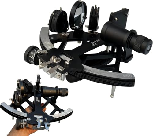
Professional Brass & Aluminum Nautical Sextant – 9 Inch Marine Navigation Instrument with Telescope, Celestial Navigation Tool for Sailors, Maritime Collectible & Gift
PROFESSIONAL DESIGN: High-precision marine sextant crafted from durable aluminum and brass, measuring 9 inches in length for accurate…
As an affiliate, we earn on qualifying purchases.
As an affiliate, we earn on qualifying purchases.
indigenous star navigation guidebook
As an affiliate, we earn on qualifying purchases.
As an affiliate, we earn on qualifying purchases.